Jun 182015


Update 18/6/2015

Between Russell and Exhibition the old trees have been removed and the kerb is being slightly altered.  We have seen the drawings and there will be no bike lane. This is despite Flinders Street being on the City of Melbourne’s long-term plan as a bicycle route.  Very long term plan, new trees and a new tram stop would be expected to last 40 years or more. No bicycle facilities.

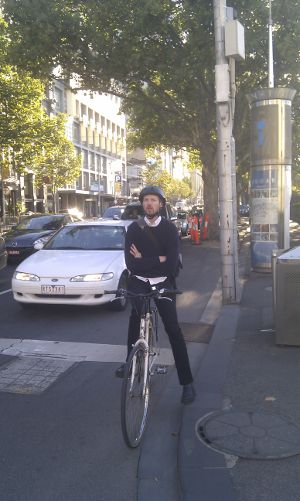
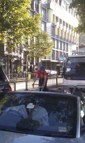
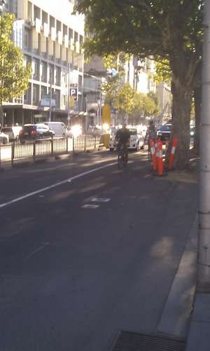
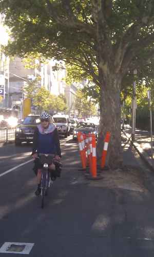
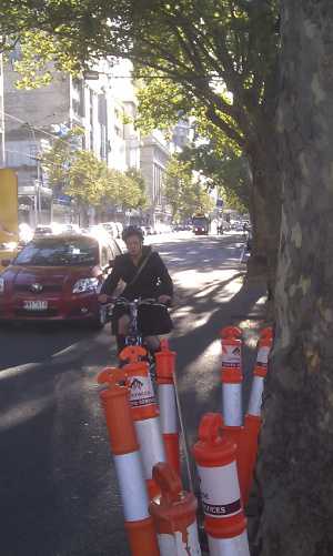
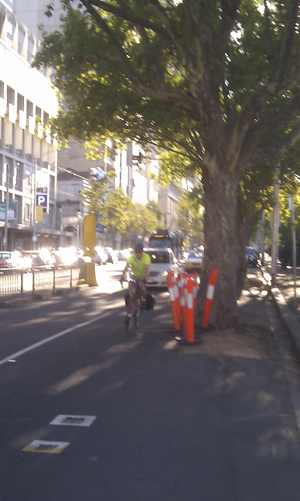
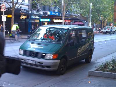
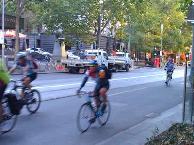
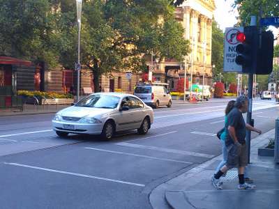
Meanwhile about 8 months ago Council painted big “no cycling” signs on the southern footpath. So it’s illegal (always was) to ride on the footpath, and dangerous and uncomfortable to ride on the road.

We like trees

Original report – March 28/2012
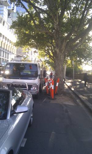
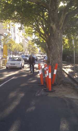
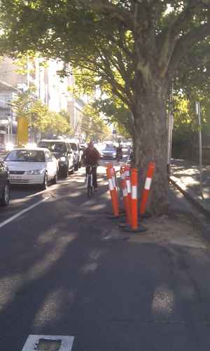
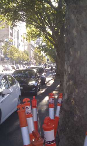
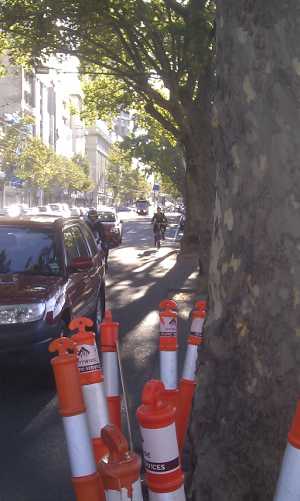
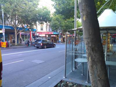
The cars that park between these trees have semi-ringbarked them over the years, crashing into them while parking. Now they are due to be replaced, getting too old and decrepit. The trees run from Spring St to Russell St on the southern side of Flinders St, forming a uniform avenue. The City of Melbourne prefers to replace a whole avenue at one time, perhaps removing healthy trees, but to retain the uniformity, creating a more pleasing visual effect as the trees grow.

Now that the trees are due to be replaced, we have the opportunity to fix this part of Vicroad’s Principle Bike Network by installing some bike lanes.  The significance of this stretch is the connections that it makes.  Melbourne’s bike network suffers many disconnects where paths don’t link to paths and lanes don’t link to lanes.  This stretch connects existing lanes and paths including:

  • Spring St bike lanes
  • Wellington Parade shared path
  • Wellington Parade South bike lanes
  • Batman Avenue shared path (toll bridge)

A connection to St Kilda Rd and Swanston St is just one block further – more on how that connection will be possible when we launch our St Kilda Road Vision next week. With this connection, a safe through route would be created from the Yarra trail through to Docklands, via Swanston St and Latrobe St (new lanes are planned for Latrobe St within the next 12 months).

When the trees are replaced, the new trees can be planted in the footpath.  The car parking can be removed – it doesn’t include any vital functions like loading bays. Melbourne BUG proposes a two-way bike lane (similar to Fitzroy St St Kilda), with a 300mm kerb to keep the cars out.

Pedestrians will benefit, because at the moment the footpath here is a de facto shared path, as cyclists escape the hostile road environment.

Yarra Trams expects to install a platform stop somewhere in the block between Exhibition and Russell.  If this is installed mid-block it will make enough room at Russell St to give cars a right turn lane and a straight-ahead lane, while maintaining the two-way bike lane to the corner.

Eventually the whole of Flinders St needs bike lanes, as planned by Vicroads in the Principle Bike Network.  This is the first step but with immediate benefits.


 Posted by at 11:27 am
Mar 292014
 

The continued lack of a south-bound bike crossing linking Napier Street, Fitzroy, and Lansdowne Street, East Melbourne, is very frustrating. For that matter, the lack of any intersection across Victoria Parade in that area that is safe for bikes is a problem.

At the moment the only legal way to cross over to Lansdowne Street from the bottom of Napier is to dismount and push your bike across two pedestrian crossings to get to the bike box in the median area for right-turning cars. Even then, the traffic light sequence doesn’t allow bikes to go forward until the cars turning right onto Lansdowne from Victoria Parade get a green light.

The whole set-up pits cyclists, pedestrians and cars against one another.

VicRoads has been promising a south-bound bike crossing at that intersection for years but nothing has happened.

 Posted by at 6:59 pm
Dec 122013
 

swanston12-2013

This photograph was taken at 12:50pm on a weekday. If you bother to read the fine print on the parking signs – which the drivers of these vehicles didn’t do – you would know it is “no standing” at this time.

The original planning for Swanston St used the words “car free”.  This was later watered down, and when the design of the new tram stops was announced the plan was changed, with the spaces between the tram stops to be “looked at” once the tram stops were in.

That time has come.

The “spaces between the tram stops” are unsatisfactory for people riding bicycles as well as for trams.  Parked vehicles force bicycles into the path of trams, or else into the very restricted, unsafe space between, at risk of falling under the tram, especially if the parked vehicle opens a door onto the passing bike rider.  Trams are regularly delayed by bikes as the latter negotiate the hostile environment.  The extensive parking opportunities are too tempting for delivery and service vehicles and Council’s enforcement strategy has failed (attached photo was taken at 12:50pm on 10/12/2013, when there should be no motor vehicles  in Swanston St).

Streets should be “readable” at a glance, and enforcement in the absence of physical corroboration does not work as the evidence above shows.

Melbourne BUG’s proposal is to widen the footpath in some sections and narrow it in others. Where the footpath is wider, about 2m should be left as a bike lane, too narrow to permit parking at any time. To provide parking bays, the footpath would move in sufficiently to allow for a small number of loading zones, which could be used for 17 hours out of 24.

While we wait for this to be implemented, Clearways should be introduced along the entire length of Swanson St to make it easier for drivers to understand there are 7 hours out of 24 when they may not park in Swanston St.

 Posted by at 4:46 pm
Nov 242013
 

While we are enjoying the new inbound lane on Princes Bridge, and the somewhat flawed outbound kerbside lane south of the bridge, the remainder of this project, budgeted for in last year’s council budget remains to be completed.

Currently when riding outbound over Princes Bridge, you have a choice of the ridiculously narrow “lane” with cars passing a few centimetres away, or using the “separated footpath”

Here’s the footpath on a recent Saturday afternoon:

princesoutbound

The final part of this overdue project needs to be completed as soon as possible.  The City of Melbourne councillors decided to wait for the trial of the inbound lane to be completed before proceeding.  That trial was a complete success and Council voted unanimously to make it permanent. Vicroads approved all parts of the project earlier this year, there are no obstacles to completing the project immediately.

By the way, here’s what is wrong with the kerbside lane running outbound beyond the bridge:

south

 Posted by at 10:20 pm
Nov 012013
 

Along its length, Lorimer St, Fishermens Bend, is poorly served with inconsistent, part-time, stop-and-start bike lanes and shared footpaths.  Lorimer St leads to an area earmarked for intensive residential development and incorporation into the Capital City Zone, so let's hope that a quality bicycle route will link it to the City in future. At the moment it is a shambles.  There is also a nearby recreational cycling route along the Yarra River – one of the problems with this is the lack of connections between the two routes – once on the river path it's difficult to access a particular point on Lorimer Street.

The shared footpath becomes unsuitable for bikes at this point.  Actually it's unsuitable to begin with.


But there is an onroad path in the same area as well as two lanes for motor vehicles.


but another few meters along, the onroad lane disappears and a shared footpath starts.


In the other direction, the bike lane disappears into the car parking:


But only for 22 hours a day:

We haven't been to see how well observed the clearway is, but chances are you would be dodging illegally parked vehicles if you tried to use the part-time "bike lane".


 Posted by at 4:41 pm
Jan 302013


In material presented to the public by the City of Melbourne, prior to the opening of the new tram stops, the words "car-free" were used.  The actual rules are supposed to make it "car-free" for 7 hours out of 24.  These words are no longer on the Council's website, instead, in a letter to Melbourne BUG, we were told that "Although it has been closed to through traffic, Swanston Street is still a shared space for authorised vehicles, trams, cyclists and pedestrians. Authorised vehicles such as police cars, Yarra Trams vehicles and vehicles associated with roadwork's or deliveries with permits can legally park in Swanston Street at different times of the day. " MElbourne BUG is not aware of any Council motion changing the status of Swanston St from "car-free" to "shared".

The BUG has been told now on several occasions that enforcement will be stepped up. The photos on this page were taken between 8:20 and 8:25 on the morning of Wednesday 30th January 2013. None of the illegally parked vehicles had been issued with a ticket.

Melbourne BUG makes the following suggestions to improve the situation:

  • Declare the seven hours a clearway, instead of just No Standing. In addition, declare it a "Clearway tow-away zone".  Clearways are easier for drivers to understand, and carry higher penalties.
  • Install flashing LED signs at all the intersections leading into Swanston Street with text "No left turn" or "No turns" (bicycles excepted). These should be switched on during the 7 "car-free" hours.  For the rest of the time, an additional sign below could add "Authorised vehicles excepted".  All the illegally parked vehicles are also breaking the no-turns rule. Making this easier to see and understand BEFORE they enter Swanston St is a better outcome.  The signs will also encourage police to enforce the no-turn rules, as drivers will have no excuse for making a mistake.


 Posted by at 10:41 am
Jan 022013
 

Received the following, relating to the 20123 Midsumma Festival:

YARRA CYCLE PATH DIVERSION
Please be advised that the Yarra Bicycle Trail at Birrarung Marr will be diverted for a period of approximately one week, as preparations are made for the 2013 Midsumma Carnival.
From Monday, 7 January through to Tuesday, 15 January, the path along the Yarra River will be diverted along Batman Avenue. Please slow down and take care when using the Path, and be aware that there will be trucks and construction vehicles in the vicinity working on the Carnival site.
Riders will be required to walk their bikes during the day of the event for the safety of the event's 120,000 expected guests. Free bike parking will be available onsite from 11:00am – 6:00pm on Sunday 13 January.
On 13 January 2013, Midsumma will transform Birrarung Marr with seven hours of free entertainment on two stages, and over 80 stalls populated by community and commercial groups.
For further information, please head to midsumma.org.au/event/carnival.

Problem: "diversion" along Batman Avenue (i.e. the toll bridge) is not a diversion, it's a one-way trip to nowhere. Do we then use Flinders Street for 2 blocks to get to St Kilda Road/Swanston Street? Does the "diversion" include a dedicated bike path along Flinders Street for these two blocks.  Don't hold your breath.

The path up to St Kilda Road is the only link between southbank and St Kilda Road and Swanston Street. It is often closed when Federation Square rents out the space, including ironically for the "Sustainable Living Festival".  This underlines the need for a permanent, unconflicted route along the southern edge of the City – Melbourne BUG suggest Flinders Street should get permanent, protected bike lanes.

*Subsequent clarification received by email, not all of Birrarung Marr will be closed, and the path through Birrarung Marr will remain open, so the Flinders Street death lottery won't be necessary on your way to Swanston Street.  The City of Melbourne prefers bikes to use this route in any case, and in the past has tried to prevent bikes riding the direct route alongside the river. So it's not surprising they are prepared to lock bikes out of the more direct route.

 Posted by at 3:52 pm
Dec 312012
 

The regional rail link project needs to close the Maribyrnong River trail (see maribyrnongregional.pdf for details) between 7/1/2013 and 30/4/2013.  They are providing a temporary bridge across the river and recommend using the eastern side of the river, then Dynon Road or Footscray Rd bridge.

While the temporary bridge sounds like excellent service, their advice to use Dynon Rd or Footscray Rd to regain the western bank is hard to understand.  We wrote to them in these terms:

Putting in a temporary bridge is excellent service, thank you.  However, we are wondering how to follow your instructions and use the Dynon Road bridge?  Are you putting in a temporary ramp from the eastern river path up to Dynon Road?  The river paths on both sides of Dynon road are at a different level and do not connect to Dynon Road, contrary to what your map seems to imply.

The problems at Footscray Rd are somewhat less, because there is a connection on the west bank between Napier St and the river path.  But on the eastern side the only way is to use Sims St, which could be hazardous.

It would be a tragedy if e.g. a family group thinking they can ride off-road to the City were to be flattened by a truck on Dynon Rd or Sims St.

If you know the area, can you comment on this, and let us know what you think?

update 2/1/2013, reply received from RRL:

In response to your enquiry, please note that the project is not installing a temporary ramp from the shared use path on the eastern side of the river up to Dynon Road. Cyclists will be able to use access points at both Dynon Rd and Footscray Rd to cross from the western path to the eastern path, while pedestrians would be advised to use the footpath at Footscray Rd, should they choose to cross the river. Pedestrians and cyclists should continue to exercise all caution while on the shared use path and at the suggested diversion points, as they would at all times when using public thoroughfares and designated paths.

Can anyone comment on these "access points" at Dynon Rd?  Footscray road is possible to access on both sides, although on the East side this involves using a truck road. Dynon Rd to our knowledge has no "access points". Please comment and correct us if we are wrong on this!
 

 Posted by at 3:05 pm
Dec 202012


Unprotected bike lane gets turned into a second car lane.  It's also bad when buses attempt to squeeze into the busstop, usually also blocking the bike lane.

Looks like the vibraline (raised lane separator) is totally ineffective.

City of Melbourne has to learn that putting down paint is not all that effective in a lot of situations.

Full sized image.

 Posted by at 1:27 am
Aug 202012
 

The photos below were taken before 9am on a weekday, opposite the Town Hall in Swanston St, you can see several motor vehicles parked in Swanston St. This is a "no standing" area at that time of day. After 9:30am "authorised" vehicles can park there. Before 7:30am vehicles with a "permit" can park there. The second photo shows the danger created by this illegal parking.

 Posted by at 9:11 am