Jun 162012
 

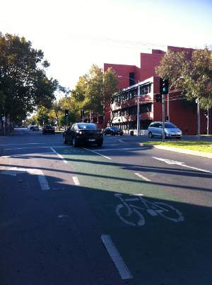
19 June:  The ban sign has been removed. The council  (full response below) say it was a ‘legitimate response’ to one collision between a pedestrian and cyclist.  Are they now going to ban cars all roads where cars have crashed into pedestrians or cyclists?

Before (sign put up around 15 June)

After (sign taken down around 19 June)

Council’s response – 19 June 2012

Dear[Melbourne BUG representative],

Cr Oke has made inquiries about this matter and been advised that the signs were put up as a legitimate response to a collision between a cyclist and a pedestrian. However, on reflection, officers concede that the community and other users weren’t consulted as thoroughly as they would normally be.  Consequently, the signs have been removed this morning and officers will now conduct some further thorough data gathering on the bridge. It is possible, however, that in the future, the signs may be put back if the statistics support doing so.

Kind regards

[Name removed] | Councillor Liaison Officer – Cr Cathy Oke | Councillor Support

Letter from Melbourne BUG – 16 June 2012

Dear Lord Mayor Robert Doyle and City of Melbourne Councillors,

Cyclists contacted Melbourne Bicycle User Group yesterday expressing concern about the new sign banning bicycles from Sandridge Bridge (see attached photo). I am writing on behalf of Melbourne BUG to ask that that council remove the ban, and associated sign, immediately. The ban is new, and there has been no community consultation. It was not discussed with Melbourne BUG. We are also unaware if it was discussed with the councillors, as it should have been.

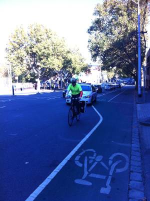
Banning cyclists from the bridge makes it harder to cross the river North-South and restricts East-West options. The bridge is an important connector from Southbank to Northbank, allowing cyclists to avoid the most crowded part of Southbank and access the bike lanes in Queensbridge Street heading south out of the City. Sandridge Bridge is wide enough cyclists and pedestrians to share, and there is also room for a dedicated cycle path if council wanted.

We also note that the ban has been imposed in isolation from the planning process. Melbourne City Council’s draft bicycle plan proposes to investigate Flinders Street as a second east-west bicycle route, and we are aware of a proposed study of an elevated route along the railway viaduct alignment. Further, production of a masterplan for the Yarra River landscape is one of the Key Strategy Activities named as part of the Council’s 2012-13 budget, which will be considered by the council at Tuesday’s committee meeting.

Your sincerely,

[Melbourne BUG representative]

 Posted by at 2:50 pm
Jun 012012
 

Clarendon Street is the southward extension of Spencer Street. The Clarendon Street Bridge is one of the four road crossings of the Yarra River entering the City. It could be an important bicycle route because of two high-quality routes that bring bikes toward the City:

  • Off-road shared path from Station Pier Port Melbourne – ends at Clarendon Street
  • On road physically separated kerbside lanes in Cecil Street South Melbourne

In the case of the Cecil Street lanes (installed by the City of Port Phillip) the City of Melbourne has identified a project in the bicycle budget for the next financial year, to continue these lanes further towards the City, ending in – Clarendon Street again. This is one of the many valuable and worthwhile projects the City is planning to implement in the coming year.

Conditions on the Clarendon Street Bridge however are appalling (for cyclists – see the video below), making these two important routes less useful than they might be. There is no safe and legal way to approach the City from Clarendon Street, not even as far as the shared paths on either bank of the Yarra River, let alone the CBD. The draft City of Melbourne Bicycle Plan, has many good projects in it but somehow the Clarendon Street Bridge is not among them.

If safe lanes were provided over the Clarendon Street Bridge, where would they get you to? After all, Spencer Street and Flinders Street are not exactly your favourite place to ride a bicycle are they? In the short term, a route towards the City along Clarendon Street would get you to the Southbank and Northbank shared paths. These paths are not ideal because they are heavily used by pedestrians and it is not attractive to either walkers or cyclists to mix under those conditions. In the longer term, the City is working towards finding a better east-west route to relieve the river paths of through bicycle traffic. Melbourne BUG supports implementing the State Government’s Principle Bicycle Network (PBN) and the inner city councils’ Inner Melbourne Action Plan (IMAP) bike network (copies of the City part of these are in the Draft Bicycle Plan) in respect of providing safe bicycle lanes in Flinders Street and Spencer Street.

The Bicycle Plan lists Flinders Street as “to be investigated” for provision of safe bicycle lanes, which the BUG supports, but the Clarendon Street bridge needs to be “investigated” at the same time, if we are not to perpetuate the gaps in the cycling network. In addition Spencer Street should be added “for investigation” as it is part of the PBN and the IMAP networks (also shown in the Bicycle Plan). Bicycle Network Victoria has an alternative proposal, to build a bridge for bicycles from Flinders Street Railway Station to Spencer Street alongside the railway viaduct. This would be expensive, but could be a good idea if it connects to the routes that go under it and at each end, including St Kilda Road (Princes Bridge), Queensbridge (where it would connect with the Sandridge Bridge shared path), and Clarendon Street.

Our proposal for the Clarendon Street Bridge is to provide a two-way bicycle road along the western edge of Clarendon Street, taking some space from the existing “kiss and ride” driveway in front of the Exhibition Centre, and continuing it over the bridge by using the existing footpath, while diverting pedestrians to the newer, under-cover walkway that crosses the river on the western side of the bridge. Perhaps this could be continued all the way up Spencer Street as a two-way bike road along the Railway Station side of Spencer Street, to link up with the proposed LaTrobe Street bicycle lanes. Imagine riding into the City from South Melbourne or Port Melbourne, crossing the river safely and either turning into Flinders Street or continuing along Spencer Street, all along safe, separated bike lanes.

Let the City know that the Clarendon Street Bridge needs to be made safe for bicycle users. Get involved in the consultation.

Any other feedback that you have about the Draft Bicycle Plan is welcomed by Melbourne BUG. Please let us know, not just about Clarendon Street, but about any part of the City of Melbourne’s draft Bicycle Plan, and help us improve our submission to make the plan even better.

 Posted by at 9:04 am
Apr 192012


It might seem strange that the highest quality non-separated bike lanes in Melbourne are being singled out as the problem of the week, here’s why.  By non-separated we mean, only paint (& vibraline) is betweeen bikes and cars, and the bike lane is between parked cars and traffic.   This is similar to two of the proposed treatments in Latrobe Street, which Council is asking for your thoughts on right now.  The Queensberry St lanes are the best of their type – wide, and with a wide, painted buffer between bikes and traffic.

The problem with Queensberry Street is that the width of the lanes is part of their problem, they are big enough to fit a car, so some drivers use them when it suits them.  Tell Council we don’t want this type of lane in Latrobe St (or on any busy road, actually).  Melbourne BUG recommends option 2a, which will be similar to the existing lanes in Swanston Street between Victoria and Grattan Streets.

 Posted by at 10:55 am
Mar 142012
 

Another road of disappearing bike lanes, Peel St is a major access road into the Central Business District.  Here we present a video of the evening peak with our comments.

Note that Peel St is the extension of William St, and is part of the Principal Bike Network, i.e. roads that the State Government considers should have bike lanes. William St was listed in the last Victorian Cycling Strategy to get permanent bike lanes (as opposed to clearway lanes that are in part of William Street now).  The BUG is hopeful that the City of Melbourne will move on William St lanes in the near future.

From Latrobe St heading north, William St has bike lanes which disappear at the difficult and dangerous roundable at Dudley St. Alongside the Victoria Market there are no bike lanes, but motor vehicles have one lane for parking and two lanes for traffic, with bikes marginalised in the dangerous door zone of the parked cars.

Bike lanes reappear north of Victoria St.

We ask the State Government to implement the PBN along Peel St to close this gap. Also the roundabout at Dudley St is dangerous for bicycles and should be abolished, replaced by traffic lights.

[youtube_sc url=”http://youtu.be/FQPA5_5KLs8″ title=”Peel%20St%20disappearing%20bike%20lanes” height=”315″ autohide=”1″ fs=”1″]

 Posted by at 11:07 am
Mar 062012
 

Ah, the Spring St bike lane. We really should do you a photo journey. The lane disappears and reappears continually on both sides.

This particular bit of it, from Victoria St to Bourke St, requires you to ride next to the doors of parked cars in order to avoid fast-moving traffic.

Just before you reach Bourke St, it disappears, leaving you the difficult task of moving forward while looking over your shoulder and trying to merge with traffic that’s moving much faster than you.

Fix it, please.

 Posted by at 10:15 pm
Feb 272012
 

Grattan St links important bike routes:

  • Flemington Rd
  • Royal Pde
  • Swanston St
  • Rathdowne St
  • Carlton Gardens to Nicholson and Gertrude Streets

But it looks like this:

Grattan St

Grattan St at Melbourne University

Until Vicroads learns how to build roundabouts that can be traversed by bicycle, escaping from the Haymarket (roundabout of death) will be necessary – Grattan St is a Haymarket bypass.
As you can see from the above photograph, there is plenty of space available. Melbourne BUG recommends kerbside, separated lanes, with parking on the right of bikes and one traffic lane. If necessary the parking lane can be a peak-hour clearway.

 Posted by at 2:11 pm