Aug 212018
 

Submission On behalf of Melbourne Bicycle User Group

The inclusion of bike lanes on Linlithgow Rd is welcome, but these must be physically protected lanes because of the volume and speed of motor traffic. The connection from the Alexander Gardens via traffic lights need to be improved. These connections will provide an alternative route to the Yarra Southbank path which is suitable only for low-speed bike “strolling” while through bicycle traffic can use the safe bike lanes along Sth Bank Bvd and Linlithgow St as a bypass.

South of the Queen Victoria Gardens, Linlithgow Ave needs to be removed as it has no purpose. There is no logic to allowing rat-running through motor traffic on this section of Linlithgow Ave because all through traffic should be on St Kilda Rd and Domain Rd.
A two-way bicycle only path should parallel the tan track from the QV Gardens to Park St Sth Yarra. Car access should be restricted to Government House and the Observatory gate/Shrine area. Linlithgow avenue divides the parklands and is a barrier to safe pedestrian movement.
Dallas Brooks Drive can remain open for access to the Herbarium Gate with a bus parking area. The remainder of Birdwood Ave should be removed as it is a waste of open space and breaks the continuity of parkland along it’s length.

Around the Shrine, jogging and cycling are not permitted but car parking is allowed (on the grass). This seems inconsistent. A dedicated small parking area could be provided off St Kilda Rd or off Domain Rd, enough to service staff and possibly some bus parking. This would remove any need for MV access via Birdwood Ave.
These changes could be made as the Metro project winds up and St Kilda Rd and Domain Rds are restored to their arterial road function.

There are no safe bicycle routes in the entire eastern half of the master plan area. Repurposing the Birdwood Ave corridor to walking, tan track & cycling will address this in part, and although beyond the scope of this masterplan, Anderson St needs protected bike lanes to complete the connectivity of this area.

 Posted by at 9:18 am
Jul 272018
 

Victorian Cycling Groups are getting together to discuss coordination and goals for this year’s State election. If your group hasn’t been contacted yet, please get in touch via our Contact Us page or register via https://www.eventbrite.com.au/e/cyclists-get-organised-for-the-2018-victorian-state-election-tickets-48150575668 to let us know you are coming.

The meeting will be from 5:30 to 8:00 PM on Tuesday August 7th at Maurice Blackburn, 380 LaTrobe St, Melbourne.

With both of the major parties giving little thought and less funding to safe bicycle infrastructure, what can we do? Come along with your ideas and goals.

 Posted by at 2:22 pm
Oct 242017
 

The Masterplan

St Kilda Rd is divided along most of its length between City of Port Phillip (CoPP) and City of Melbourne (CoM). St. Kilda Road is the main commuter route for people who ride bikes from the south eastern suburbs into the city, with over 3000 cyclists per day. It is the second most dangerous street for cyclists in Melbourne, with 174 crashes between 2006 and 2015. There is a narrow bicycle lane, with ‘car dooring’ a major concern on this route.

For about 10 years now a masterplan has been in preparation by CoM, CoPP has been working hard to get safe bike lanes and VicRoads has done the preparatory work to make it happen.

History

Current St Kilda Rd bikelanes: 

The masterplan has never reached the stage of a draft for public comment, but has always included protected bike lanes. About eight years ago, this was leaked to the media who door-stopped the then roads minister (now treasurer of Victoria) Tim Pallas about the idea. His off-the-cuff reaction was to reject safe bikelanes in favour of “easing congestion” for cars. The masterplan then gathered dust for about four years before the Balieu Government was elected in 2010 and indicated they were willing to take a fresh look at St Kilda Rd. City of Port Phillip, City of Melbourne and Local liberal member Clem Newtown-Brown pushed hard for safe bicycle lanes on St Kilda Road.

After forming government in 2014 Labor promised to investigate protected bicycle lanes. During construction of the Domain Station, motor traffic in St Kilda Road is constrained, creating a once in a lifetime opportunity to construct safe bike lanes while traffic levels are low. VicRoads spent six months and over $300,000 investigating options for protected bicycle lanes. The study outcomes haven’t been released but Vicroads has looked at protected lanes in the centre of St Kilda Rd, adjacent to the tram tracks.  This time it was the Premier who was asked on talkback radio and replied “we won’t be having any of that”. Although the project hasn’t been officially cancelled, the Premier’s comment makes progress unlikely.  City of Port Phillip stated http://www.portphillip.vic.gov.au/apr-2017-media_6957.htm that they would prefer footpath adjacent protected lanes.

Centre-of-road Lanes

No details are known for the design of centre-of-road lanes. If done well with effective separation from cars, with controlled turns at all intersections to remove conflict with motor vehicles, centre-of-road lanes would be much better than the current door-zone lanes. We believe however that a superior option exists which should be considered. Please read on and give us your comments below.

Melboune BUG’s proposal

Melbourne BUG’s proposal is for bike lanes adjacent to the footpath, with a buffer between bikes and cars provided by the nature strip (grass and trees) as well as the car-parking lane. This is possible because the trees in St Kilda Rd are old and due to be replaced, so new trees can be located closer to the centre of the road. Putting a protected lane in the usual position, next to the kerb, is problematic owing to the large number of driveways, so while the current door-zone lane hides bikes from cars leaving driveways, a kerbside lane will hide bikes from cars leaving the road. Putting the lane next to the footpath, with effective delineation to deter pedestrian ingress, will create space for a car to wait out of the traffic lane before or after crossing the footpath and bikelane. Cars will cross the bike lane at right angles, with good visibility. The footpath and bikelane could be raised to present “piano keys” to cars, slowing them on the approach.

Locating the bike lane adjacent to the footpath recognises that bike riders are vulnerable road users, more similar to pedestrians than to cars. Whilst the current users of St Kilda Rd might include many who are commuting into the City, we know that most people will only cycle short distances. They aren’t doing it at the moment because they don’t feel safe, but provided with safe lanes they will be more likely to. Using a bike to access addresses along St Kilda Rd will be encouraged by these lanes. Centre-of-road lanes are possible in a small number of roads in Melbourne. Changing driver behaviour will be more successful if road layouts are well understood and predictable. Making St Kilda Rd different to 99.9% of Melbourne’s roads is not ideal.

Dockless Share Bikes

The emergence of dockless bikeshare will also encourage short trips by bicycle. The huge success of these bikes is a game-changing opportunity to take cycling mainstream. Massive uptake of share bikes will make short trips by bike common and an attractive way to get to nearby destinations.

We believe that focusing on what current cyclists want is only part of the story, and there are many people not currently using bikes who will find ubiquitous dockless sharebikes very convenient. We base this forecast on the experience of other cities as well as Melbourne’s experience so far.

 A centre-of-road lane works against short trips by making it harder to access mid-block destinations.

Trams

Trams on St Kilda Rd will continue to dominate movement for longer trips but share bikes could take over for short trips. Also, surprisingly, trams can’t cope with the load against the peak direction, as anyone trying to get into the City in the evening peak would know. Imagine watching full trams bypass your stop, and seeing a share bike sitting on the nature strip next to the safe bike lane.

Evaluate both options

Our position is that government should evaluate both options with costed designs for each and public debate about their relative merits.

 Posted by at 11:12 am
Apr 232017
 

SYDNEY ROAD IS CHANGING SOON

Planning is underway for major changes in Sydney Rd including disability access tram stops and possibly protected bike lanes, wider footpaths and better use of parking off Sydney Road.

This is a once in a lifetime chance to make Sydney Road safe and welcoming for all road users. Moving parking off street will allow wider footpaths, protected bike lanes and trams no longer held up waiting for car parking movements.

Come and help the campaign, next meeting Thursday 6pm, St Ambrose church meeting room 287 sydney Rd Brunswick.

For more information see Revitalise Sydney Road.
 Posted by at 4:08 pm
Dec 272016
 

Whatever your opinion on a one-meter passing law, good data is hard to come by to know for sure either way.  It might be the #157th most important thing to make riding a bike safer and more popular, or it might be the next best thing after protected bike lanes and filtered permeability.  States that have introduced this law have done no before-and-after studies to determine whether there was any effect, beneficial or otherwise. Victoria may introduce a 1m law soon, so time is short to rectify this data deficit and get measurements before a law exists, and to continue with measurement after a law is introduced.

You can help by volunteering to mount a PassBox on your bike for a week on our website for this project at http://passboxmelbourne.com/.


 Posted by at 1:05 pm
Sep 112016
 

Read our Our detailed plan for South Bank Boulevard and then sign the petition!

Our petition has the key improvements that Melbourne needs to attract more people to cycling for everyday trips. Except for St Kilda Rd lanes, Council hasn’t supported these in the past, so we will be asking candidates to sign a pledge to support these things:

  • Protected lanes with protected intersections on Southbank Boulevard
  • The 2016-2020 bicycle plan – implemented in full
  • Protected lanes on St Kilda Road
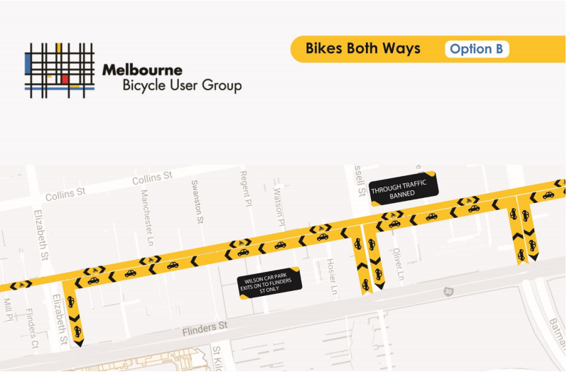
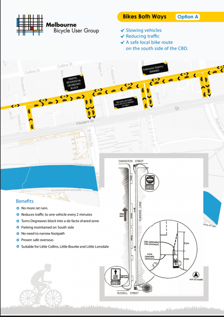
  • A safe route through the south side of the CBD
  • Protected lanes on Flemington Road.
 Posted by at 4:29 pm
Jun 182015
 

Green paint (in places) is all that will join two of Melbourne’s rare protected bike lanes, and only during peak hours.
Failing to learn from the part time, part way, paint only, parked in bike “lanes” in Exhibition St, The City of Melbourne has announced similar poor quality provision between the protected lanes in Latrobe Street and Albert Street.  This is a lost opportunity to connect two (Melbourne only has three) protected bike lanes and link them with a facility of similar high standard.

Eastbound, going up Latrobe St will require a right turn into Exhibition, then a block of Little Lonsdale St, which is not wide enough to accommodate a bicycle and a car – so you will need to hold up the traffic and ride up the middle of the street. Then make another right turn, into Spring St.
Coming into the city will be a peak hour only clearway bike lane – we know from Exhibition Street how well that works. Then a right turn into Spring St and another part time unprotected lane.

If you are coming in from Fitzroy you will have to go out of your way to reach this excellent facility because Vicroads determined that Victoria Parade is not for bicycles (too narrow presumably), then come back up to La Trobe St, or else if you are turning left at Nicholson Street, risk the dangerously narrow car-door bike lane to get to Spring St. It’s a dangerous door-zone lane because the City of Melbourne is unwilling to remove four car parking spaces.

This is not the way to make cycling an attractive option for the average person.  It is a way to ensure cycling stays a small niche of the transport system.

 Posted by at 2:56 pm
May 092014
 

The City of Melbourne is consulting on its renewal of Vic Markets. This could potentially have a large impact of the bike-friendliness of the whole area.

Make your submission here.

For inspiration, read Melbourne BUG’s submission, below:

Melbourne BUG – Submission on Queen Victoria Market renewal proposal

    1. Car Park

In addition to car parking spaces, we would like to see secure bicycle parking in this area as well. This secure parking should cater for QVM employees as well as customers who request additional security, for example because they ride an expensive e-bike that they would not want to park using the standard above-ground facilities. We think the secure bicycle parking area should therefore be split into two parts. One part for employees only, accessible by swipe key and including end-of-trip facilities, and the other part for customers using bike lockers (http://www.cora.com.au/bikelockers/cyclesafebicyclelockers/ for example). The entry to/exit from the secure bicycle parking should be separate from the car entry, so that bicycles will not have to navigate a queue of cars lining up to enter the garage or swerve around access poles.


    1. Access

We feel that the QVM infrastructure and surrounding area should be inviting people to walk or ride their bicycle to the market, and doing so should be rewarded. This reward can come in many flavours, most importantly a sense of safety and comfort relative to using a car. The ‘inviting infrastructure’ consists of several elements in our view.


Firstly, being able to safely access the new QVM by foot or bike will be paramount to its success in our opinion. With car ownership and use being actively discouraged with new developments in the CBD, many of the CBD residents will come to market as pedestrians. At the same time, the trend in surrounding suburbs is quite clear as well: bicycle use for everyday transport is on the rise and this will continue into the future as more and more people realize the convenience of riding a bike in and around the city. The City of Melbourne Transport Strategy states: “We are a walking and cycling city, and Council provides infrastructure to improve the safety and convenience of cyclists and pedestrians” (p4).


Assets that help to provide bicycle access to the QVM are the separated bike lanes on La Trobe St and part of Elizabeth St north, and the improved bike lanes planned for William St . However, the Elizabeth St lanes do not reach all the way to Victoria St/Therry St, and the William St lanes need to continue the length of Peel St, being the continuation of William St immediately adjacent to the QVM. The City of Melbourne Bicycle Plan 2012-16 states “Investigate options for a separated or quality route from Dudley Street to Royal  Parade and Flemington Road. This route will also service the Queen Victoria Market and Flagstaff Gardens.” (p20).


In addition, the redesign of Franklin St provides an  opportunity for council to equip it with protected bike lanes and a safe crossing at the new Franklin-Peel-Dudley intersection. Elimination of roundabouts at Peel/Dudley and Queen/Franklin will improve access and safety for pedestrians and cyclists. Franklin Street currently provides four traffic lanes plus parking which is excessive relative to its local function, and this should be reduced to two traffic lanes to provide safe space for bicycles and more pedestrian space. Retaining four lanes in Franklin St and creating a new four lane road on the market’s southern boundary will create and perpetuate a barrier between the market and the City: as stated in the Summary of Proposals: “The streets around the Market form barriers to the local area and make it difficult to walk around”. Safe bicycle lanes in Franklin St will improve access to the Market by connecting to other bike routes such as William St and Swanston St.

We also feel that the connection to QVM from Cobden St and/or O’Connell St should be improved for bicycle access to/from Queensberry St which would be the preferred route for most of North Melbourne and Kensington. We strongly encourage council to design a “Bicycle Access Plan” for QVM which integrates the above points and potentially other routes, as well as traffic management around the entry/exit points of the car park, to limit the danger to cyclists of cars queuing on street or doing right hand turns to enter/exit the car park. This is particularly important for those routes that are part of the Principal Bike Network like Peel Street. The Bicycle Access Plan should be included in the QVM masterplan.

Another important element to create the inviting atmosphere is the provision of bicycle parking facilities. In addition to the secure bicycle parking in the car park area, we feel there should be ample bicycle parking available at various strategic locations around the QVM  making it easy to park your bike close to where you need to go. These locations need to relate to the bicycle access routes shown in the “Bicycle Access Plan”.One can even think about “shopping carts” to be supplied at the bicycle parks to make it easier for people to carry their purchases around and back to the bike. It’s easy to carry 5-10kgs of fresh produce on your bike in a pannier or basket, but it’s much less fun to carry it around while shopping. Well positioned parking and innovations such as “shopping carts” will also encourage cyclists to use the parking facilities provided and avoid bicycle clutter at other locations.

 Posted by at 9:51 am
Dec 102013
 

Update 24/12/2013

Council has informed Melbourne BUG that their proposal to continue the bicycle lane to the intersection was refused by the State Government (through Vicroads), with the following justification (Council’s statements are in italics, our responses are in bold font).

The likely impacts of the proposed Melbourne BUG treatment are outlined below.
 
Less green time for cyclists: the proposal would require extensive changes to the traffic signals at this intersection. Because cyclists and turning traffic would need to be time separated under the proposal, there would be significantly less green traffic signal time for cyclists. Therefore cyclists would have longer wait times and may be tempted to ignore the signals.
 
Less green time for pedestrians: the proposal would also require fully controlled left turns, thus potentially reducing pedestrian green times, and leading to longer waits and longer queues for left turn vehicles in Elizabeth Street.  
The additional time offered by the current design is only useful if you are prepared to ride, or walk across the intersection at the same time as cars are turning. Bikes are very efficient at moving through an intersection, a given number of people on bikes can traverse an intersection much more quickly than the same number of cars.
 
Limited road space: given the width of Elizabeth Street between the existing kerbs, we could not provide a bicycle lane, a physically separated island, a turn lane and two through lanes at appropriate widths. Providing narrower lanes or a narrower physical separator may compromise safety.
Given the width of Elizabeth Street at this point, it is a telling indication of the Victorian Government’s priorities to hear that there would be insufficient width to provide a safe bicycle lane.
 
Intersection capacity and efficiency: given the impacts outlined above, the proposal would reduce the efficiency and capacity of the intersection (how many vehicles / bicycles would pass through during each green cycle).
It’s all about facilitating people driving their cars to work. Morning peak is when the left turning cars are a congestion problem.
 
The current Elizabeth Street design has been utilised in other areas of the City of Melbourne, and has been found to be effective.  The turning motorists will cross the bicycle lane when entering the turn lane and safety at this potential conflict point is managed through green cycle lane pavement.  Cyclists and motorists should of course approach the conflict area with awareness and share the road.
Do you find this type of treatment effective? Do you feel safe?
 
The approved design removes the conflict between angle parking (and reversing vehicles) and cyclists and therefore offers a major improvement to cyclist safety over the existing conditions.
The kerbside lane, as far as it goes, is a major improvement, and is supported by Melbourne BUG.
 
As with all other bicycle installations, the City of Melbourne will monitor the safety and effectiveness of the Elizabeth Street physically-separated bicycle lanes and any safety issues arising from the treatment will be discussed with VicRoads
Be sure to report any crashes to Council.  Police also, but they are unlikely to record any crashes unless somebody is taken to hospital.

Original Post 10/12/2013

Elizabeth Street proposed "separated" bike lane design

Above is the graphic describing the proposed “kerbside” bikelane in Elizabeth St. These lanes will run on both sides of Elizabeth Street between the Haymarket roundabout and Queensberry Street.  You can see that bikes will emerge from behind the parked cars, immediately into the path of left-turning cars.  The cars have a green arrow for part of the cycle, so they are expecting to have absolute right-of-way and won’t be slowing down. The cars won’t see bikes coming down the hill, until they come out in front of them.

Melbourne BUG’s proposal, given to Council at an early stage, was to keep the bikelane kerbside all the way to the stop line. Left-turning cars and straight-ahead bikes can be separated in time and space by using the traffic light cycle. There is a turning phase already in use here, when cars turn right from Queensberry into Elizabeth, exiting the City, and left turning cars coming towards the City down Elizabeth St get a green left-turn arrow. During this phase, bikes would get a red light (stopping straight-ahead movement but still allowing left turns into the Queensberry St bike lane). During the straight-ahead green light in Elizabeth St, left-turning cars would get a red arrow under the BUG’s proposal, making it safe for cyclists to go straight ahead.

The type of design proposed by Melbourne BUG is standard in the Netherlands, and is increasingly in use in Copenhagen.

The design proposed by the City of Melbourne undermines the purpose of the protected bike lane. Why does the protection run out where it is needed most, at the intersection?

Answer, the City of Melbourne doesn’t believe in its own Transport Strategy.

For example, page 50 of the Transport Strategy includes “Traditionally, traffic growth has been met by allocating more space to cars often at the expense of trams, buses, pedestrians and cycling…the municipality’s road network needs to be optimised for the more space-efficient modes, including dedicated lanes for trams, bus priority lanes, bicycles lanes, wider pedestrian footpaths, safer and more comfortable level access tram stops and significantly better priority for space efficient vehicles at traffic lights especially trams, buses and pedestrians.

The City’s “Road Safety Plan” states on page 25 “…the City of Melbourne proposes a city where people take priority over the flow of traffic.” and “…the City of Melbourne clearly prioritises pedestrians, cyclists and motorcyclists, particularly within the central city as having a key role in the future prosperity, liveability and sustainability of the city. On this basis…vulnerable road users should be supported by the physical environment…”

In practice, not so much.

Please write to Cr Cathy Oke, chair of Council’s transport committee and ask for the BUG’s safer design to be implemented.

Cr Cathy Oke
Phone: 03 9658 9086
Email: cathy.oke@melbourne.vic.gov.au

City of Melbourne
GPO Box 1603
Melbourne VIC 3001

 Posted by at 5:05 pm